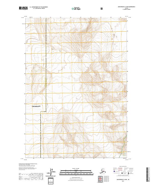
2023 Map of Anchorage A-4 NW
USGS Topo · Published 2023About this map
Chugach National Forest marks the southeastern corner of this terrain, where the high-elevation contours define a landscape shaped by the steep gradients of the Alaskan wilderness. The boundary of Anchorage and the Anchorage Municipality Chugach Census Area transects the western portion of the sheet, dividing the administrative reach of the city from the protected federal lands to the east. This survey emphasizes the verticality of the region, using dense contour intervals to illustrate the complex drainage patterns and ridgelines that characterize the transition from municipal limits into the undeveloped backcountry of south-central Alaska.
Find a feature on this map
7 named features on this map. Tap any name to fly to it.
Don’t see what you’re looking for? This feature index may not catch every label — zoom into the map to look around manually.
Map Details
Editions of this 2023 Anchorage A-4 NW Map
This is the sole edition of this map. No revisions or reprints were ever made.
Other maps of this area

1951 · Anchorage
USGS Topo · 1:250,000

1960 · Anchorage A-5
USGS Topo · 1:63,360

1960 · Anchorage A-4
USGS Topo · 1:63,360

1960 · Anchorage B-5
USGS Topo · 1:63,360

1960 · Anchorage B-4
USGS Topo · 1:63,360

1962 · Anchorage
USGS Topo · 1:250,000

1979 · Anchorage
USGS Topo · 1:250,000

1994 · Anchorage B-4
USGS Topo · 1:63,360
1994 · Anchorage B-5
USGS Topo · 1:63,360
2013 · Anchorage B-4 SW
USGS Topo · 1:25,000