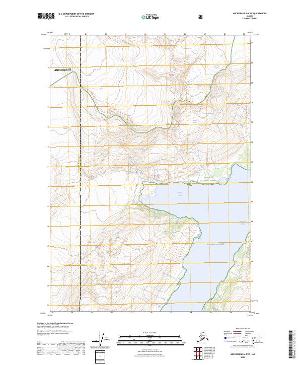
2023 Map of Anchorage A-4 SW
USGS Topo · Published 2023About this map
Chugach National Forest provides the setting for this detailed survey of the glacial systems and marine inlets along the south-central Alaskan coastline. The landscape is dominated by massive ice features, including Surprise Glacier and Serpentine Glacier, which feed into the waters of Surprise Inlet. These topographical patterns illustrate the ongoing geological movement within the Anchorage municipality, where the high peaks like Mt Muir transition sharply into the Pacific Ocean.
Find a feature on this map
19 named features on this map. Tap any name to fly to it.
Don’t see what you’re looking for? This feature index may not catch every label — zoom into the map to look around manually.
Map Details
Editions of this 2023 Anchorage A-4 SW Map
This is the sole edition of this map. No revisions or reprints were ever made.
Other maps of this area

1951 · Seward
USGS Topo · 1:250,000

1951 · Anchorage
USGS Topo · 1:250,000

1951 · Seward D-5
USGS Topo · 1:63,360

1951 · Seward D-4
USGS Topo · 1:63,360

1952 · Seward D-5
USGS Topo · 1:63,360

1952 · Seward D-4
USGS Topo · 1:63,360

1953 · Seward
USGS Topo · 1:250,000

1959 · Seward
USGS Topo · 1:250,000

1960 · Anchorage A-5
USGS Topo · 1:63,360

1960 · Anchorage A-4
USGS Topo · 1:63,360