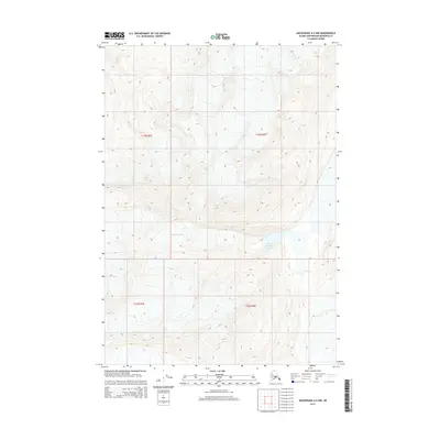
2015 Map of Anchorage A-5 NW
USGS Topo · Published 2015About this map
Whiteout Glacier and the expansive Lake George dominate this high-altitude landscape within the Anchorage Municipality. The 2015 topography reveals a dramatic environment where ice and water interact, characterized by significant elevation changes across the township lines of t13n r3e, t13n r4e, t12n r3e, and t12n r4e. The interaction between the glacial terminus and the lake suggests a dynamic hydrological system typical of this part of Alaska. While no human settlements are labeled, the detailed contouring provides essential data for understanding the physical geography and ice movements of the region during the early twenty-first century. This map is a critical reference for those studying the physical evolution of the Chugach Mountains area.
Find a feature on this map
6 named features on this map. Tap any name to fly to it.
Don’t see what you’re looking for? This feature index may not catch every label — zoom into the map to look around manually.
Map Details
Editions of this 2015 Anchorage A-5 NW Map
This is the sole edition of this map. No revisions or reprints were ever made.
Other maps of this area

1951 · Anchorage
USGS Topo · 1:250,000

1960 · Anchorage A-6
USGS Topo · 1:63,360

1960 · Anchorage B-6
USGS Topo · 1:63,360

1960 · Anchorage A-5
USGS Topo · 1:63,360

1960 · Anchorage B-5
USGS Topo · 1:63,360

1962 · Anchorage
USGS Topo · 1:250,000

1979 · Anchorage
USGS Topo · 1:250,000
1994 · Anchorage A-6
USGS Topo · 1:63,360
1994 · Anchorage B-6
USGS Topo · 1:63,360
1994 · Anchorage B-5
USGS Topo · 1:63,360