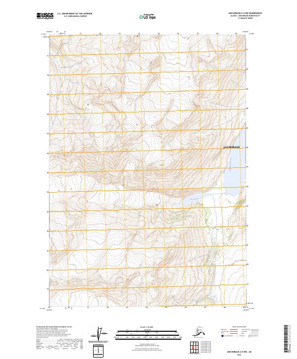
2023 Map of Anchorage A-5 NW
USGS Topo · Published 2023About this map
Lake George sits within the high-elevation terrain of this 2023 survey, positioned east of the glacial drainage that feeds the Lake Fork Knik River. The map area is defined by the eastern boundary of the Anchorage municipality, where steep topographic contours illustrate a landscape shaped by ice and water. Unlike the urbanized core of the region, this specific quadrangle focuses on the transition between freshwater lakes and the braided river systems that characterize the glacial valleys north of the city. The detail provided by the Lake Fork Knik River labels suggests a complex hydrological network where mountain runoff meets tidal influences further downstream.
Find a feature on this map
7 named features on this map. Tap any name to fly to it.
Don’t see what you’re looking for? This feature index may not catch every label — zoom into the map to look around manually.
Map Details
Editions of this 2023 Anchorage A-5 NW Map
This is the sole edition of this map. No revisions or reprints were ever made.
Other maps of this area

1951 · Anchorage
USGS Topo · 1:250,000

1960 · Anchorage A-6
USGS Topo · 1:63,360

1960 · Anchorage B-6
USGS Topo · 1:63,360

1960 · Anchorage A-5
USGS Topo · 1:63,360

1960 · Anchorage B-5
USGS Topo · 1:63,360

1962 · Anchorage
USGS Topo · 1:250,000

1979 · Anchorage
USGS Topo · 1:250,000
1994 · Anchorage A-6
USGS Topo · 1:63,360
1994 · Anchorage B-6
USGS Topo · 1:63,360
1994 · Anchorage B-5
USGS Topo · 1:63,360