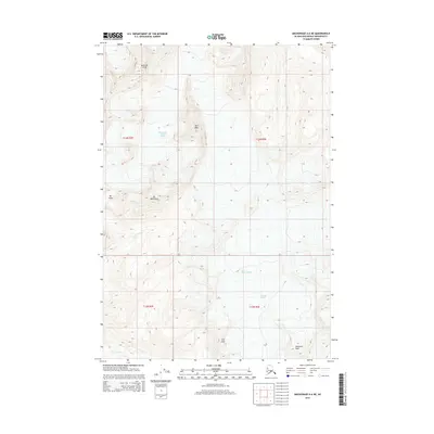
2015 Map of Anchorage A-6 NE
USGS Topo · Published 2015About this map
Bellicose Peak and Peril Peak define the high-altitude landscape of this 2015 survey, where glacial ice and mountain summits dominate the Chugach Mountains east of Anchorage. The topography reveals a complex network of frozen hydrology, including the West Branch Eklutna Glacier and the expansive Ted Stevens Icefield. These ice-covered regions feed into the Eagle River, which drains the western slopes of the range. Prominent landmarks such as Mt Yukla and Mt Beelzebub stand near the glacial margins, while further south, Whiteout Peak rises above the Whiteout Glacier. The map provides a precise record of these permanent ice features and their surrounding ridges, illustrating the relationship between high peaks and the glaciers that carve them in this northern wilderness.
Find a feature on this map
14 named features on this map. Tap any name to fly to it.
Don’t see what you’re looking for? This feature index may not catch every label — zoom into the map to look around manually.
Map Details
Editions of this 2015 Anchorage A-6 NE Map
This is the sole edition of this map. No revisions or reprints were ever made.
Other maps of this area

1951 · Anchorage
USGS Topo · 1:250,000

1960 · Anchorage A-6
USGS Topo · 1:63,360

1960 · Anchorage B-6
USGS Topo · 1:63,360

1960 · Anchorage A-5
USGS Topo · 1:63,360

1960 · Anchorage B-5
USGS Topo · 1:63,360

1962 · Anchorage
USGS Topo · 1:250,000

1979 · Anchorage
USGS Topo · 1:250,000
1994 · Anchorage A-6
USGS Topo · 1:63,360
1994 · Anchorage B-6
USGS Topo · 1:63,360
1994 · Anchorage B-5
USGS Topo · 1:63,360