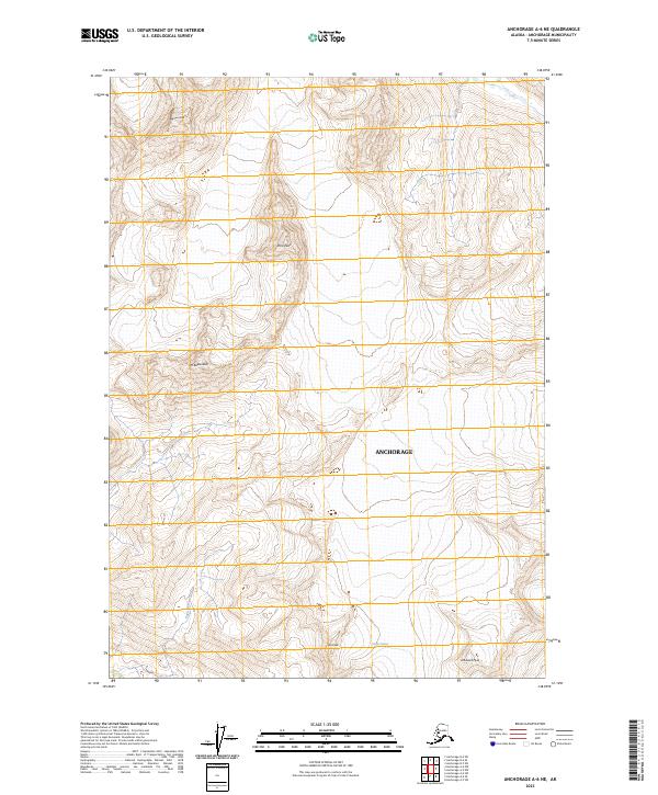
2023 Map of Anchorage A-6 NE
USGS Topo · Published 2023About this map
Bellicose Peak and Mt Beelzebub dominate this high-elevation landscape within the Anchorage municipality, where the terrain is defined by extreme relief and glacial activity. The western portion of the map follows the winding course of the Eagle River, which drains the meltwater from ice fields further east. In the southern reaches, the Eagle Glacier flows between Hut Peak and Whiteout Peak, illustrating the ongoing glacial processes that shape this subarctic environment. The lack of roads or permanent structures reflects the wilderness character of this area, as documented in the 2023 survey by the U.S. Geological Survey. Researchers can trace the drainage patterns and township boundaries, including t13n r3e and t12n r2e, across a landscape where geological nomenclature such as Peril Peak hints at the formidable nature of the local topography.
Find a feature on this map
12 named features on this map. Tap any name to fly to it.
Don’t see what you’re looking for? This feature index may not catch every label — zoom into the map to look around manually.
Map Details
Editions of this 2023 Anchorage A-6 NE Map
This is the sole edition of this map. No revisions or reprints were ever made.
Other maps of this area

1951 · Anchorage
USGS Topo · 1:250,000

1960 · Anchorage A-6
USGS Topo · 1:63,360

1960 · Anchorage B-6
USGS Topo · 1:63,360

1960 · Anchorage A-5
USGS Topo · 1:63,360

1960 · Anchorage B-5
USGS Topo · 1:63,360

1962 · Anchorage
USGS Topo · 1:250,000

1979 · Anchorage
USGS Topo · 1:250,000
1994 · Anchorage A-6
USGS Topo · 1:63,360
1994 · Anchorage B-6
USGS Topo · 1:63,360
1994 · Anchorage B-5
USGS Topo · 1:63,360