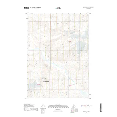
2021 Map of Anchorage A-6 NW
USGS Topo · Published 2021About this map
The Eagle River cuts a wide path through this high-elevation region of the Anchorage municipality, where several prominent peaks define the skyline. Mt Yukla stands as a primary landmark in the eastern portion of the survey, while Polar Bear Peak and Organ Mtn rise to the south, overlooking the drainage basins of Raven Cr and Camp Cr. The landscape is characterized by steep elevation changes and glacially carved valleys, with the Dew Mound Trl providing one of the few established routes through the western terrain. To the north, Peters Cr flows through the upper reaches of the map, illustrating the complex hydrology of the Chugach Mountains area. This 2021 edition reflects the modern topographic state of these protected lands, capturing the intersection of glacial water systems and high-altitude summits.
Find a feature on this map
13 named features on this map. Tap any name to fly to it.
Don’t see what you’re looking for? This feature index may not catch every label — zoom into the map to look around manually.
Map Details
Editions of this 2021 Anchorage A-6 NW Map
This is the sole edition of this map. No revisions or reprints were ever made.
Other maps of this area

1951 · Anchorage
USGS Topo · 1:250,000

1960 · Anchorage A-6
USGS Topo · 1:63,360

1960 · Anchorage B-7
USGS Topo · 1:63,360

1960 · Anchorage B-6
USGS Topo · 1:63,360

1960 · Anchorage A-7
USGS Topo · 1:63,360

1962 · Anchorage
USGS Topo · 1:250,000
1979 · Anchorage B-7 SE
USGS Topo · 1:25,000

1979 · Anchorage
USGS Topo · 1:250,000
1979 · Anchorage A-7 NE
USGS Topo · 1:25,000
1993 · Anchorage A-7 NE
USGS Topo · 1:25,000