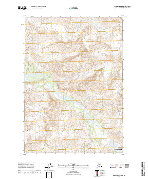
2023 Map of Anchorage A-6 NW
USGS Topo · Published 2023About this map
Mt Yukla and Polar Bear Peak dominate the topography of this wilderness area east of the primary coastal settlements in the municipality of Anchorage. The landscape is defined by the sharp relief of the Chugach Mountains, where high-altitude peaks overlook glacial-fed drainages. Eagle River flows northwest through the center of the sheet, carving a wide valley that serves as a primary corridor through the mountainous terrain. Smaller tributaries including Raven Creek and Camp Creek cut into the slopes of Organ Mtn, illustrating the complex drainage patterns of this high-elevation region. The survey also records the northern reaches of Peters Creek, showing the relationship between the dramatic alpine summits and the river systems that move glacial melt toward the coast. This map focuses on the undeveloped mountain interior, emphasizing terrain and water features over human infrastructure.
Find a feature on this map
12 named features on this map. Tap any name to fly to it.
Don’t see what you’re looking for? This feature index may not catch every label — zoom into the map to look around manually.
Map Details
Editions of this 2023 Anchorage A-6 NW Map
This is the sole edition of this map. No revisions or reprints were ever made.
Other maps of this area

1951 · Anchorage
USGS Topo · 1:250,000

1960 · Anchorage A-6
USGS Topo · 1:63,360

1960 · Anchorage B-7
USGS Topo · 1:63,360

1960 · Anchorage B-6
USGS Topo · 1:63,360

1960 · Anchorage A-7
USGS Topo · 1:63,360

1962 · Anchorage
USGS Topo · 1:250,000
1979 · Anchorage B-7 SE
USGS Topo · 1:25,000

1979 · Anchorage
USGS Topo · 1:250,000
1979 · Anchorage A-7 NE
USGS Topo · 1:25,000
1993 · Anchorage A-7 NE
USGS Topo · 1:25,000