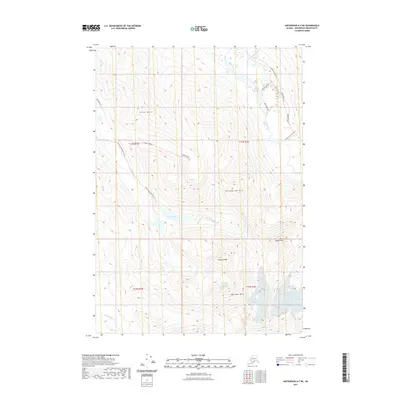
2021 Map of Anchorage A-7 NE
USGS Topo · Published 2021About this map
Harp Mtn and Hurdygurdy Mtn dominate this high-elevation landscape within the t13n r1w and t13n r1e townships, showcasing the dramatic verticality of the Chugach Range. The central focus of the drainage is Eagle Lake, which feeds the S Fork Eagle River as it descends toward the valley floor. The map documents a sophisticated network of recreational access, with the South Fork Eagle River Trl and Hanging Valley Trl providing passage through the steep terrain.
Find a feature on this map
23 named features on this map. Tap any name to fly to it.
Don’t see what you’re looking for? This feature index may not catch every label — zoom into the map to look around manually.
Map Details
Editions of this 2021 Anchorage A-7 NE Map
This is the sole edition of this map. No revisions or reprints were ever made.
Other maps of this area

1951 · Anchorage
USGS Topo · 1:250,000

1960 · Anchorage A-6
USGS Topo · 1:63,360

1960 · Anchorage B-7
USGS Topo · 1:63,360

1960 · Anchorage B-6
USGS Topo · 1:63,360

1960 · Anchorage A-7
USGS Topo · 1:63,360

1962 · Anchorage
USGS Topo · 1:250,000

1979 · Anchorage B-7 SW
USGS Topo · 1:25,000
1979 · Anchorage B-7 SE
USGS Topo · 1:25,000

1979 · Anchorage
USGS Topo · 1:250,000
1979 · Anchorage A-7 NE
USGS Topo · 1:25,000