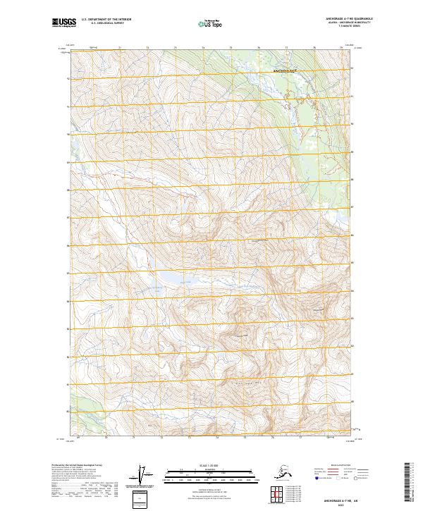
2023 Map of Anchorage A-7 NE
USGS Topo · Published 2023About this map
The headwaters of the South Fork Eagle River and North Fork Ship Creek define this high-elevation landscape within the municipality of Anchorage. Centered on the glacially carved basins of Eagle Lake and Symphony Lake, the area is punctuated by prominent summits including Eagle Peak, Harp Mtn, and Calliope Mtn. The map documents a transition from the suburban edge near Hiland Road into the backcountry of the Chugach Mountains, where established routes like the Symphony Lake Trl and Hanging Valley Trl provide access to the interior. The drainage patterns around Dew Mound and Falling Water Creek illustrate the complex alpine hydrology of the region. This 2023 survey serves as a precise record of the trail networks and water bodies that characterize the remote eastern reaches of the Anchorage area.
Find a feature on this map
25 named features on this map. Tap any name to fly to it.
Don’t see what you’re looking for? This feature index may not catch every label — zoom into the map to look around manually.
Map Details
Editions of this 2023 Anchorage A-7 NE Map
This is the sole edition of this map. No revisions or reprints were ever made.
Other maps of this area

1951 · Anchorage
USGS Topo · 1:250,000

1960 · Anchorage A-6
USGS Topo · 1:63,360

1960 · Anchorage B-7
USGS Topo · 1:63,360

1960 · Anchorage B-6
USGS Topo · 1:63,360

1960 · Anchorage A-7
USGS Topo · 1:63,360

1962 · Anchorage
USGS Topo · 1:250,000

1979 · Anchorage B-7 SW
USGS Topo · 1:25,000
1979 · Anchorage B-7 SE
USGS Topo · 1:25,000

1979 · Anchorage
USGS Topo · 1:250,000
1979 · Anchorage A-7 NE
USGS Topo · 1:25,000