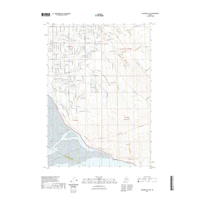
2021 Map of Anchorage A-8 SE
USGS Topo · Published 2021About this map
Potter Marsh serves as a transitional point between the suburban growth of the hillside and the wilder reaches of the coast along the Turnagain Arm. This survey captures a landscape of intense elevation changes, where residential developments like Lake Hideaway and Lake O' the Hills are tucked into the lower slopes before the terrain ascends sharply into the Chugach Range. The intricate network of residential streets, including O'Malley Road and Huffman Road, illustrates the expansion of local neighborhoods upward from the coastal flats.
Find a feature on this map
153 named features on this map. Tap any name to fly to it.
Don’t see what you’re looking for? This feature index may not catch every label — zoom into the map to look around manually.
Map Details
Editions of this 2021 Anchorage A-8 SE Map
This is the sole edition of this map. No revisions or reprints were ever made.
Other maps of this area

1951 · Seward
USGS Topo · 1:250,000

1951 · Anchorage
USGS Topo · 1:250,000

1951 · Seward D-8
USGS Topo · 1:63,360

1951 · Seward D-7
USGS Topo · 1:63,360

1952 · Seward D-8
USGS Topo · 1:63,360

1952 · Seward D-7
USGS Topo · 1:63,360

1952 · Anchorage A-8
USGS Topo · 1:63,360

1953 · Anchorage A-8
USGS Topo · 1:63,360

1953 · Seward
USGS Topo · 1:250,000

1959 · Seward
USGS Topo · 1:250,000