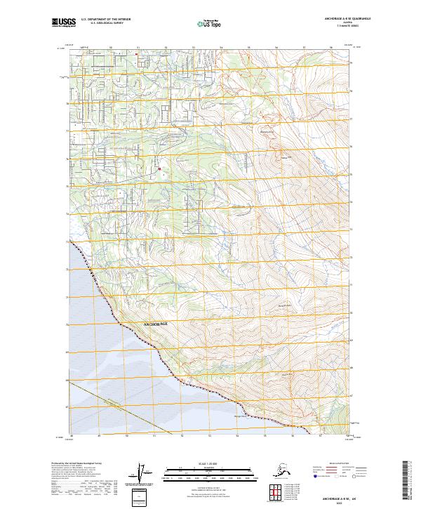
2023 Map of Anchorage A-8 SE
USGS Topo · Published 2023About this map
Potter Marsh and the coastal wetlands near Beluga Point define the southern reaches of this landscape where the mountains meet the sea. The terrain rises sharply from the shore of the Seward Highway toward the interior peaks of the Chugach Range, including Flattop Mtn and McHugh Peak. This area reflects a transition from the dense residential grid of the northern Hillside neighborhoods, characterized by winding roads like Huffman Road and De Armoun Road, to the undeveloped alpine heights.
Find a feature on this map
64 named features on this map. Tap any name to fly to it.
Don’t see what you’re looking for? This feature index may not catch every label — zoom into the map to look around manually.
Map Details
Editions of this 2023 Anchorage A-8 SE Map
This is the sole edition of this map. No revisions or reprints were ever made.
Other maps of this area

1951 · Seward
USGS Topo · 1:250,000

1951 · Anchorage
USGS Topo · 1:250,000

1951 · Seward D-8
USGS Topo · 1:63,360

1951 · Seward D-7
USGS Topo · 1:63,360

1952 · Seward D-8
USGS Topo · 1:63,360

1952 · Seward D-7
USGS Topo · 1:63,360

1952 · Anchorage A-8
USGS Topo · 1:63,360

1953 · Anchorage A-8
USGS Topo · 1:63,360

1953 · Seward
USGS Topo · 1:250,000

1959 · Seward
USGS Topo · 1:250,000