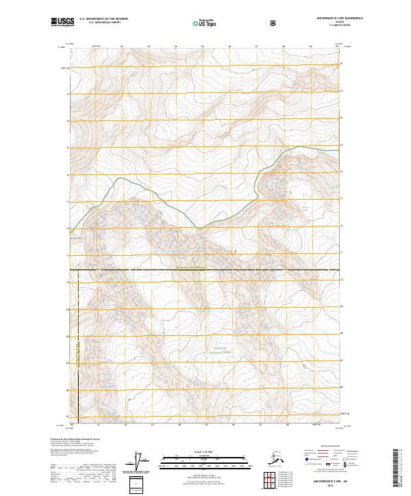
2023 Map of Anchorage B-2 NW
USGS Topo · Published 2023About this map
Mt Marcus Baker dominates the high alpine landscape of this 2023 survey, marking the intersection of significant administrative and geographic boundaries. The map documents a rugged glacial environment within the Chugach National Forest, defined by the massive frozen expanse of the Harvard Glacier. The terrain character is revealed through intricate contour lines that trace the descent from high mountain peaks into glacial valleys. This modern data collection by the U.S. Geological Survey also delineates the complex boundary between the Matanuska-Susitna Borough Copper River Census Area and the Chugach Census Area Copper River Census Area, providing a precise record of contemporary Alaskan wilderness management and jurisdictional lines.
Find a feature on this map
11 named features on this map. Tap any name to fly to it.
Don’t see what you’re looking for? This feature index may not catch every label — zoom into the map to look around manually.
Map Details
Editions of this 2023 Anchorage B-2 NW Map
This is the sole edition of this map. No revisions or reprints were ever made.
Other maps of this area

1951 · Anchorage
USGS Topo · 1:250,000

1960 · Anchorage C-2
USGS Topo · 1:63,360

1960 · Anchorage C-3
USGS Topo · 1:63,360

1960 · Anchorage B-3
USGS Topo · 1:63,360

1960 · Anchorage B-2
USGS Topo · 1:63,360

1962 · Anchorage
USGS Topo · 1:250,000

1979 · Anchorage
USGS Topo · 1:250,000
1993 · Anchorage C-2
USGS Topo · 1:63,360

1993 · Anchorage C-3
USGS Topo · 1:63,360
2013 · Anchorage C-2 SW
USGS Topo · 1:25,000