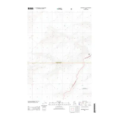
2013 Map of Anchorage B-3 NE
USGS Topo · Published 2013About this map
Mount Marcus Baker dominates the eastern edge of this high-altitude landscape, marking a prominent peak in a region defined by extensive ice fields. This 2013 survey documents the massive reaches of the Knik Glacier and Marcus Baker Glacier, which carve through the terrain within the northern reaches of the Chugach National Forest. The map also captures the boundary between Matanuska-Susitna and Valdez-Cordova, illustrating how political lines are drawn across these formidable geological features. To the southeast, the head of the Harvard Glacier begins its descent, providing a detailed look at the glacial convergence points that shape the Chugach Range drainage systems.
Find a feature on this map
6 named features on this map. Tap any name to fly to it.
Don’t see what you’re looking for? This feature index may not catch every label — zoom into the map to look around manually.
Map Details
Editions of this 2013 Anchorage B-3 NE Map
This is the sole edition of this map. No revisions or reprints were ever made.
Other maps of this area

1951 · Anchorage
USGS Topo · 1:250,000

1960 · Anchorage C-2
USGS Topo · 1:63,360

1960 · Anchorage C-3
USGS Topo · 1:63,360

1960 · Anchorage B-3
USGS Topo · 1:63,360

1960 · Anchorage B-2
USGS Topo · 1:63,360

1962 · Anchorage
USGS Topo · 1:250,000

1979 · Anchorage
USGS Topo · 1:250,000
1993 · Anchorage C-2
USGS Topo · 1:63,360

1993 · Anchorage C-3
USGS Topo · 1:63,360
2013 · Anchorage C-2 SW
USGS Topo · 1:25,000