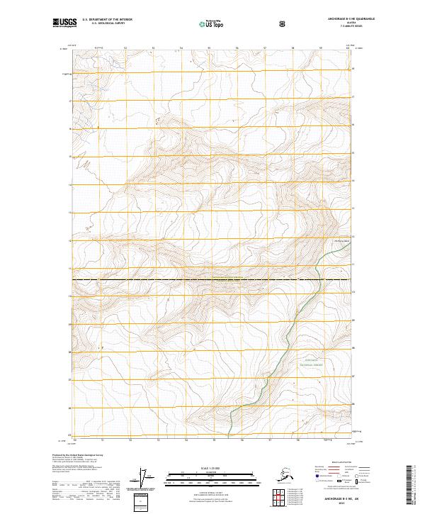
2023 Map of Anchorage B-3 NE
USGS Topo · Published 2023About this map
Mt Marcus Baker anchors the eastern edge of this high-altitude landscape, where massive glaciers and severe vertical relief define the southern Chugach Mountains. The territory is split by the administrative line of the Matanuska-Susitna Borough Chugach Census Area, marking a transition between local borough authority and federal census oversight. The southern portion of the sheet is protected within the Chugach National Forest, a region primarily composed of permanent ice fields and steep rock faces. The 120-foot contour intervals underscore the extreme nature of this terrain, which remains largely untouched by roads or permanent settlements. The map detail highlights the intersection of several townships, including t16n r9e and t15n r9e, providing a precise grid for high-alpine navigation and land management.
Find a feature on this map
7 named features on this map. Tap any name to fly to it.
Don’t see what you’re looking for? This feature index may not catch every label — zoom into the map to look around manually.
Map Details
Editions of this 2023 Anchorage B-3 NE Map
This is the sole edition of this map. No revisions or reprints were ever made.
Other maps of this area

1951 · Anchorage
USGS Topo · 1:250,000

1960 · Anchorage C-2
USGS Topo · 1:63,360

1960 · Anchorage C-3
USGS Topo · 1:63,360

1960 · Anchorage B-3
USGS Topo · 1:63,360

1960 · Anchorage B-2
USGS Topo · 1:63,360

1962 · Anchorage
USGS Topo · 1:250,000

1979 · Anchorage
USGS Topo · 1:250,000
1993 · Anchorage C-2
USGS Topo · 1:63,360

1993 · Anchorage C-3
USGS Topo · 1:63,360
2013 · Anchorage C-2 SW
USGS Topo · 1:25,000