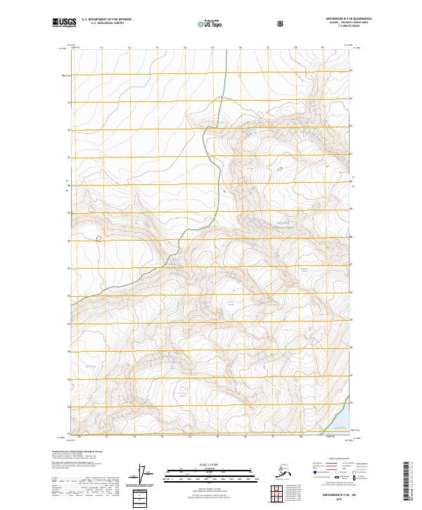
2023 Map of Anchorage B-3 SE
USGS Topo · Published 2023About this map
Chugach National Forest encompasses the entirety of this landscape, where high-altitude ice fields and deep fjords define the geography of the Chugach Census Area. The map highlights the significant glacial activity that characterizes the region, with the massive Barry Glacier and Bryn Mawr Glacier flowing south toward the waters of the Harvard Arm. These ice masses are essential for understanding the historical movement of coastal glaciers and their impact on the surrounding coastline.
Find a feature on this map
12 named features on this map. Tap any name to fly to it.
Don’t see what you’re looking for? This feature index may not catch every label — zoom into the map to look around manually.
Map Details
Editions of this 2023 Anchorage B-3 SE Map
This is the sole edition of this map. No revisions or reprints were ever made.
Other maps of this area

1951 · Anchorage
USGS Topo · 1:250,000

1960 · Anchorage A-2
USGS Topo · 1:63,360

1960 · Anchorage A-3
USGS Topo · 1:63,360

1960 · Anchorage B-3
USGS Topo · 1:63,360

1960 · Anchorage B-2
USGS Topo · 1:63,360

1962 · Anchorage
USGS Topo · 1:250,000

1979 · Anchorage
USGS Topo · 1:250,000

2013 · Anchorage B-2 SW
USGS Topo · 1:25,000
2013 · Anchorage B-3 SE
USGS Topo · 1:25,000
2013 · Anchorage A-3 NW
USGS Topo · 1:25,000