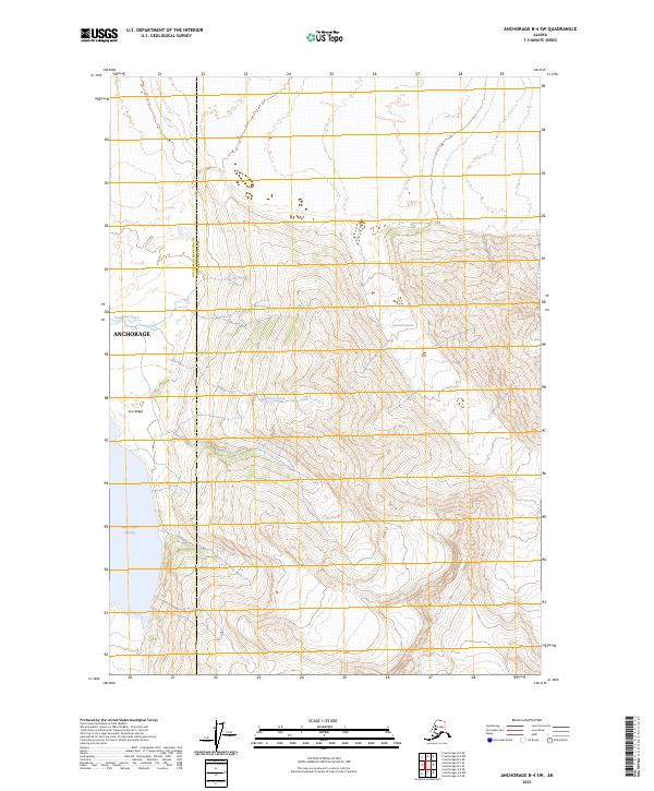
2023 Map of Anchorage B-4 SW
USGS Topo · Published 2023About this map
Gannett Glacier dominates the upper elevations of this terrain within the Anchorage Municipality Chugach Census Area, where steep topographic contours descend toward the valley of Fourteen Creek. The landscape transitions from high ice fields and ridge lines, such as Low Ridge, to the waters of Inner Lake George in the western portion of the quadrangle. This 2023 survey by the U.S. Geological Survey illustrates a largely undeveloped section of the Anchorage region, defined by its complex glacial drainage patterns and high-altitude features. The layout of Township and Range lines, including t14n r6e and t15n r6e, provides the primary framework for navigation across this roadless expanse of the Chugach Mountains.
Find a feature on this map
12 named features on this map. Tap any name to fly to it.
Don’t see what you’re looking for? This feature index may not catch every label — zoom into the map to look around manually.
Map Details
Editions of this 2023 Anchorage B-4 SW Map
This is the sole edition of this map. No revisions or reprints were ever made.
Other maps of this area

1951 · Anchorage
USGS Topo · 1:250,000

1960 · Anchorage A-5
USGS Topo · 1:63,360

1960 · Anchorage A-4
USGS Topo · 1:63,360

1960 · Anchorage B-5
USGS Topo · 1:63,360

1960 · Anchorage B-4
USGS Topo · 1:63,360

1962 · Anchorage
USGS Topo · 1:250,000

1979 · Anchorage
USGS Topo · 1:250,000

1994 · Anchorage B-4
USGS Topo · 1:63,360
1994 · Anchorage B-5
USGS Topo · 1:63,360
2013 · Anchorage B-4 SW
USGS Topo · 1:25,000