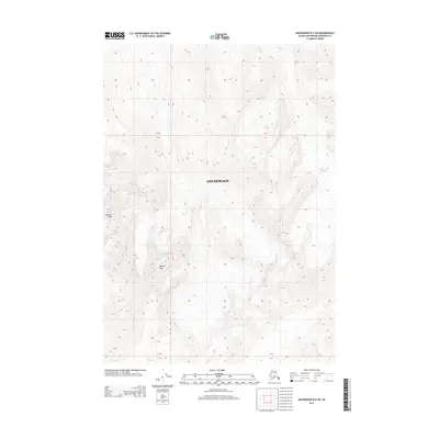
2013 Map of Anchorage B-5 SW
USGS Topo · Published 2013About this map
Bashful Peak and Baleful Peak dominate this high-elevation Alaskan landscape within the Anchorage municipality. The terrain is defined by dramatic vertical relief and glacial activity, most notably represented by the Hunter Creek Glacier in the northeastern quadrant. This ice mass feeds into Hunter Cr, which carves through the steep mountain passes. The map documents a wilderness environment where human infrastructure is entirely absent, focusing instead on the precise topographic contours of the Chugach Mountains. It serves as a detailed record of glacial boundaries and peak elevations in the early twenty-first century, providing essential data for studying the shifting alpine environment of Southcentral Alaska.
Find a feature on this map
8 named features on this map. Tap any name to fly to it.
Don’t see what you’re looking for? This feature index may not catch every label — zoom into the map to look around manually.
Map Details
Editions of this 2013 Anchorage B-5 SW Map
This is the sole edition of this map. No revisions or reprints were ever made.
Other maps of this area

1951 · Anchorage
USGS Topo · 1:250,000

1960 · Anchorage A-6
USGS Topo · 1:63,360

1960 · Anchorage B-6
USGS Topo · 1:63,360

1960 · Anchorage A-5
USGS Topo · 1:63,360

1960 · Anchorage B-5
USGS Topo · 1:63,360

1962 · Anchorage
USGS Topo · 1:250,000

1979 · Anchorage
USGS Topo · 1:250,000
1994 · Anchorage A-6
USGS Topo · 1:63,360
1994 · Anchorage B-6
USGS Topo · 1:63,360
1994 · Anchorage B-5
USGS Topo · 1:63,360