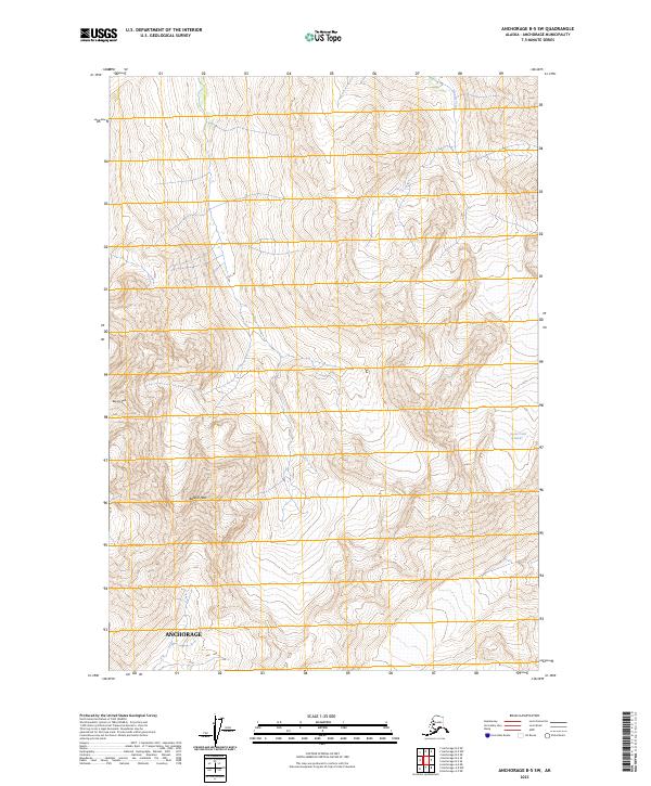
2023 Map of Anchorage B-5 SW
USGS Topo · Published 2023About this map
Bashful Peak and Baleful Peak dominate this landscape within the Anchorage municipality, where the high-altitude terrain of the Chugach Mountains dictates the natural flow of the land. The northeastern corner is defined by the Hunter Creek Glacier, a significant ice feature that feeds into the headwaters of Hunter Creek. This 2023 survey illustrates the complex glacial topography and steep vertical relief that characterize the interior of this coastal municipality. Unlike the developed urban core of the region, this specific quadrangle focuses on the primitive wilderness and hydrological systems, tracing the precise drainage patterns and ice fields that remain untouched by modern infrastructure.
Find a feature on this map
11 named features on this map. Tap any name to fly to it.
Don’t see what you’re looking for? This feature index may not catch every label — zoom into the map to look around manually.
Map Details
Editions of this 2023 Anchorage B-5 SW Map
This is the sole edition of this map. No revisions or reprints were ever made.
Other maps of this area

1951 · Anchorage
USGS Topo · 1:250,000

1960 · Anchorage A-6
USGS Topo · 1:63,360

1960 · Anchorage B-6
USGS Topo · 1:63,360

1960 · Anchorage A-5
USGS Topo · 1:63,360

1960 · Anchorage B-5
USGS Topo · 1:63,360

1962 · Anchorage
USGS Topo · 1:250,000

1979 · Anchorage
USGS Topo · 1:250,000
1994 · Anchorage A-6
USGS Topo · 1:63,360
1994 · Anchorage B-6
USGS Topo · 1:63,360
1994 · Anchorage B-5
USGS Topo · 1:63,360