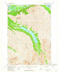
1960 Map of Anchorage B-6
USGS Topo · Published 1964About this map
Eklutna Lake dominates the central valley of this northern Chugach landscape as it appeared in the early 1960s. The map illustrates the industrial infrastructure of the era, specifically the Aqueduct and the Eklutna Powerhouse located near the Glenn Highway. This transportation corridor follows the southern bank of the Knik River, providing a vital link through the mountainous terrain.
Find a feature on this map
15 named features on this map. Tap any name to fly to it.
Don’t see what you’re looking for? This feature index may not catch every label — zoom into the map to look around manually.
Map Details
Editions of this 1960 Anchorage B-6 Map
5 editions found
Other maps of this area

1950 · Anchorage C-7
USGS Topo · 1:63,360

1951 · Anchorage
USGS Topo · 1:250,000

1951 · Anchorage C-6
USGS Topo · 1:63,360

1951 · Anchorage C-7
USGS Topo · 1:63,360

1951 · Anchorage C-5
USGS Topo · 1:63,360

1952 · Anchorage C-7
USGS Topo · 1:63,360

1952 · Anchorage C-5
USGS Topo · 1:63,360

1960 · Anchorage A-6
USGS Topo · 1:63,360

1960 · Anchorage B-7
USGS Topo · 1:63,360

1960 · Anchorage B-6
USGS Topo · 1:63,360