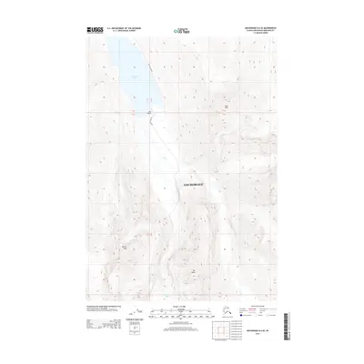
2013 Map of Anchorage B-6 SE
USGS Topo · Published 2013About this map
Eklutna Lake dominates the northern landscape of this 2013 survey, serving as a focal point for the surrounding high-altitude terrain in Anchorage. The map captures a moment when infrastructure remains sparse, centered primarily on the access provided by Eklutna Lake Rd leading toward the southern shore. Near the southern tip of the lake, Bold Airport provides a critical touchpoint for aviation-dependent transport in this isolated environment. Rising sharply from the water's edge are prominent summits including Bold Peak, Benign Peak, and the distinctive formation known as The Mitre. These features illustrate the dramatic verticality of the region, where narrow corridors of human activity like the small airfield are dwarfed by the massive geological structures that define this part of the municipality.
Find a feature on this map
7 named features on this map. Tap any name to fly to it.
Don’t see what you’re looking for? This feature index may not catch every label — zoom into the map to look around manually.
Map Details
Editions of this 2013 Anchorage B-6 SE Map
This is the sole edition of this map. No revisions or reprints were ever made.
Other maps of this area

1951 · Anchorage
USGS Topo · 1:250,000

1960 · Anchorage A-6
USGS Topo · 1:63,360

1960 · Anchorage B-6
USGS Topo · 1:63,360

1960 · Anchorage A-5
USGS Topo · 1:63,360

1960 · Anchorage B-5
USGS Topo · 1:63,360

1962 · Anchorage
USGS Topo · 1:250,000

1979 · Anchorage B-6 NW
USGS Topo · 1:25,000

1979 · Anchorage
USGS Topo · 1:250,000
1994 · Anchorage A-6
USGS Topo · 1:63,360
1994 · Anchorage B-6
USGS Topo · 1:63,360