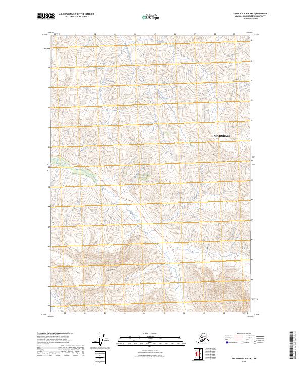
2023 Map of Anchorage B-6 SW
USGS Topo · Published 2023About this map
Thunder Bird Creek and Peters Creek carve through the high elevations of the Chugach Mountains within the Anchorage municipality. The landscape is defined by significant vertical relief, rising from the creek beds to the summits of Thunder Bird Peak and Peeking Mtn. Human presence in this steep environment is largely limited to recreation and transit, specifically via the Peters Creek Trl, which provides access through the valley systems. The map reflects a modern topographical record of the Chugach State Park region, where the intersection of water drainage patterns and high mountain peaks dictates the local geography and the path of primitive trails.
Find a feature on this map
12 named features on this map. Tap any name to fly to it.
Don’t see what you’re looking for? This feature index may not catch every label — zoom into the map to look around manually.
Map Details
Editions of this 2023 Anchorage B-6 SW Map
This is the sole edition of this map. No revisions or reprints were ever made.
Other maps of this area

1951 · Anchorage
USGS Topo · 1:250,000

1960 · Anchorage A-6
USGS Topo · 1:63,360

1960 · Anchorage B-7
USGS Topo · 1:63,360

1960 · Anchorage B-6
USGS Topo · 1:63,360

1960 · Anchorage A-7
USGS Topo · 1:63,360

1962 · Anchorage
USGS Topo · 1:250,000

1979 · Anchorage B-6 NW
USGS Topo · 1:25,000
1979 · Anchorage B-7 SE
USGS Topo · 1:25,000
1979 · Anchorage B-7 NE
USGS Topo · 1:25,000

1979 · Anchorage
USGS Topo · 1:250,000