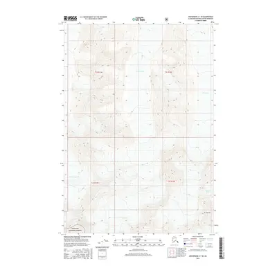
2016 Map of Anchorage C-1 SE
USGS Topo · Published 2016About this map
Sylvester Glacier and Tarr Glacier dominate the northern terrain of this Chugach mountain landscape, flowing through steep glacial valleys toward the Matanuska-Susitna interior. In the south, the massive Ted Stevens Icefield feeds into the Nelchina Glacier system, marking a high-elevation accumulation zone where ice and rock define the topography. The jagged peak of Mt Siegfried stands as a primary landmark in the southeast, situated just north of the Chugach National Forest boundary. This 2016 survey documents the contemporary extent of these glacial features, providing a precise record of the ice margins and high-altitude drainage patterns in the eastern Chugach Range.
Find a feature on this map
10 named features on this map. Tap any name to fly to it.
Don’t see what you’re looking for? This feature index may not catch every label — zoom into the map to look around manually.
Map Details
Editions of this 2016 Anchorage C-1 SE Map
This is the sole edition of this map. No revisions or reprints were ever made.
Other maps of this area

1951 · Anchorage
USGS Topo · 1:250,000

1952 · Valdez
USGS Topo · 1:250,000

1960 · Anchorage B-1
USGS Topo · 1:63,360

1960 · Valdez B-8
USGS Topo · 1:63,360

1960 · Valdez C-8
USGS Topo · 1:63,360

1960 · Anchorage C-1
USGS Topo · 1:63,360

1960 · Valdez
USGS Topo · 1:250,000

1962 · Anchorage
USGS Topo · 1:250,000

1979 · Anchorage
USGS Topo · 1:250,000
1993 · Valdez C-8
USGS Topo · 1:63,360