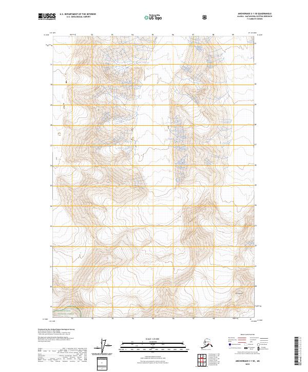
2023 Map of Anchorage C-1 SE
USGS Topo · Published 2023About this map
Chugach National Forest encompasses the high-altitude terrain shown in this 2023 survey of the Matanuska-Susitna region. The landscape is defined by massive glacial features, most notably the southern reaches of the Harvard Glacier which dominates the southwestern corner of the quadrangle. Rising above the ice and steep contours, Mt Siegfried stands as a prominent topographical landmark in the southeastern section. This map provides a modern record of the ice coverage and relief in a remote part of the Alaska range where the intersection of township and range lines like t3s r11w and t4s r10w mark out a wilderness largely untouched by permanent settlement or road infrastructure.
Find a feature on this map
9 named features on this map. Tap any name to fly to it.
Don’t see what you’re looking for? This feature index may not catch every label — zoom into the map to look around manually.
Map Details
Editions of this 2023 Anchorage C-1 SE Map
This is the sole edition of this map. No revisions or reprints were ever made.
Other maps of this area

1951 · Anchorage
USGS Topo · 1:250,000

1952 · Valdez
USGS Topo · 1:250,000

1960 · Anchorage B-1
USGS Topo · 1:63,360

1960 · Valdez B-8
USGS Topo · 1:63,360

1960 · Valdez C-8
USGS Topo · 1:63,360

1960 · Anchorage C-1
USGS Topo · 1:63,360

1960 · Valdez
USGS Topo · 1:250,000

1962 · Anchorage
USGS Topo · 1:250,000

1979 · Anchorage
USGS Topo · 1:250,000
1993 · Valdez C-8
USGS Topo · 1:63,360