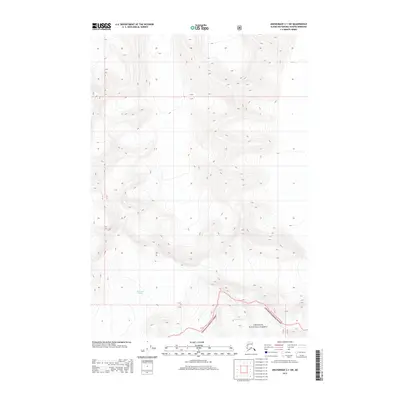
2013 Map of Anchorage C-1 SW
USGS Topo · Published 2013About this map
Matanuska Glacier and Harvard Glacier dominate this high-altitude landscape in the Chugach Mountains as it appeared in 2013. This specialized survey focuses on the icy divide where these massive frozen rivers descend from the peaks, providing a record of glacial extent and elevation within the Chugach National Forest. The map detail is defined almost entirely by steep topographic contours and the movement of ice, with few human-made landmarks present. For researchers, this sheet captures the specific boundaries and surface features of the glaciers before more recent environmental shifts, mapping the transition between the Chugach Range and the ice fields that feed the surrounding river systems.
Find a feature on this map
7 named features on this map. Tap any name to fly to it.
Don’t see what you’re looking for? This feature index may not catch every label — zoom into the map to look around manually.
Map Details
Editions of this 2013 Anchorage C-1 SW Map
This is the sole edition of this map. No revisions or reprints were ever made.
Other maps of this area

1951 · Anchorage
USGS Topo · 1:250,000

1960 · Anchorage C-2
USGS Topo · 1:63,360

1960 · Anchorage B-1
USGS Topo · 1:63,360

1960 · Anchorage B-2
USGS Topo · 1:63,360

1960 · Anchorage C-1
USGS Topo · 1:63,360

1962 · Anchorage
USGS Topo · 1:250,000

1979 · Anchorage
USGS Topo · 1:250,000
1993 · Anchorage C-2
USGS Topo · 1:63,360
2013 · Anchorage C-2 NE
USGS Topo · 1:25,000
2013 · Anchorage C-1 NW
USGS Topo · 1:25,000