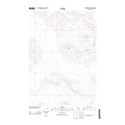
2013 Map of Anchorage C-2 SE
USGS Topo · Published 2013About this map
Matanuska Glacier dominates the northern reaches of this high-elevation terrain in the Matanuska-Susitna Borough. This landscape is defined by its high summits, including a cluster of peaks named for Nordic nations: Denmark Peak, Norway Peak, Sweden Peak, and Finland Peak. The map provides an intricate look at the glacial geography and steep topographic contours that characterize this portion of the Chugach Mountains. Surveyed in 2013, the document captures the precise state of the ice and mountain ridges, offering a specific record of the glacial extent and drainage patterns that feed into the larger river systems of the region. The lack of roads or established settlements emphasizes the wilderness character of these highlands, where geographic features are defined primarily by ice and elevation.
Find a feature on this map
9 named features on this map. Tap any name to fly to it.
Don’t see what you’re looking for? This feature index may not catch every label — zoom into the map to look around manually.
Map Details
Editions of this 2013 Anchorage C-2 SE Map
This is the sole edition of this map. No revisions or reprints were ever made.
Other maps of this area

1951 · Anchorage
USGS Topo · 1:250,000

1960 · Anchorage C-2
USGS Topo · 1:63,360

1960 · Anchorage B-1
USGS Topo · 1:63,360

1960 · Anchorage B-2
USGS Topo · 1:63,360

1960 · Anchorage C-1
USGS Topo · 1:63,360

1962 · Anchorage
USGS Topo · 1:250,000

1979 · Anchorage
USGS Topo · 1:250,000
1993 · Anchorage C-2
USGS Topo · 1:63,360
2013 · Anchorage C-2 SW
USGS Topo · 1:25,000
2013 · Anchorage C-1 SW
USGS Topo · 1:25,000