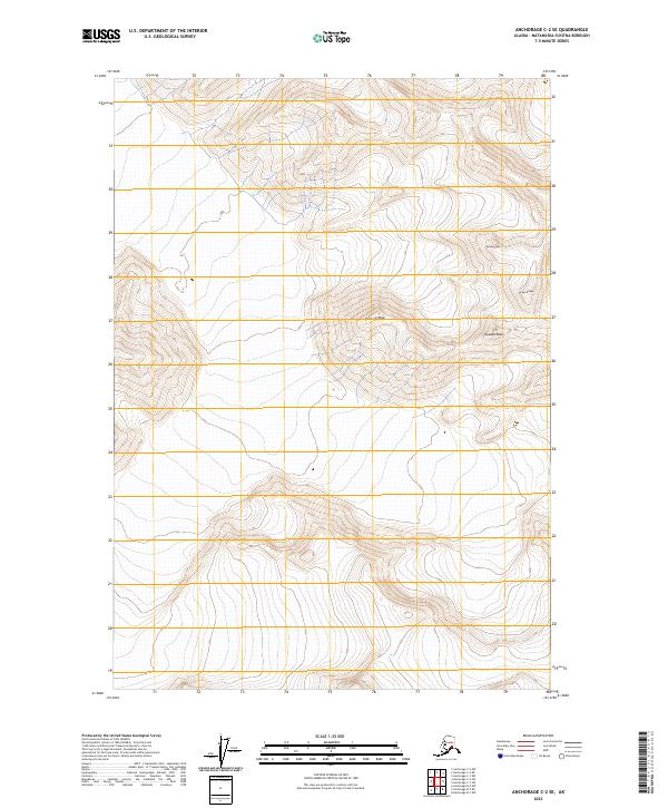
2023 Map of Anchorage C-2 SE
USGS Topo · Published 2023About this map
Norway Peak and Sweden Peak stand as prominent landmarks in this high-altitude section of the Matanuska-Susitna Borough. The landscape is defined by its dramatic relief, captured in this 2023 elevation study which highlights several peaks named for Scandinavian nations, including Denmark Peak and Finland Peak. This survey provides a contemporary record of the topographic character of the region, emphasizing the glacial and alpine terrain that has long shaped the geography of south-central Alaska. The grid layout, marking townships such as t17n r11e and t18n r11e, illustrates the systematic land division overlaying these massive physical features, offering a clear view of the wilderness as it was documented in the early 2020s.
Find a feature on this map
10 named features on this map. Tap any name to fly to it.
Don’t see what you’re looking for? This feature index may not catch every label — zoom into the map to look around manually.
Map Details
Editions of this 2023 Anchorage C-2 SE Map
This is the sole edition of this map. No revisions or reprints were ever made.
Other maps of this area

1951 · Anchorage
USGS Topo · 1:250,000

1960 · Anchorage C-2
USGS Topo · 1:63,360

1960 · Anchorage B-1
USGS Topo · 1:63,360

1960 · Anchorage B-2
USGS Topo · 1:63,360

1960 · Anchorage C-1
USGS Topo · 1:63,360

1962 · Anchorage
USGS Topo · 1:250,000

1979 · Anchorage
USGS Topo · 1:250,000
1993 · Anchorage C-2
USGS Topo · 1:63,360
2013 · Anchorage C-2 SW
USGS Topo · 1:25,000
2013 · Anchorage C-1 SW
USGS Topo · 1:25,000