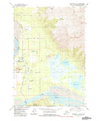
1979 Map of Anchorage C-6 SE
USGS Topo · Published 1984About this map
Bodenburg Butte rises sharply above the glacial valley floor between the Matanuska River and the Knik River, anchoring a landscape of small agricultural plots and growing residential pockets. The 1970s character of the area is defined by its educational and recreational hubs, including the Matanuska Valley Sch, the Polar Raceway Park, and the Butte Municipal Airport. Settlement is concentrated along the Bodenburg Loop Road, where the Valley Memory Garden (Cemetery) and First Baptist Ch serve the local community of Butte. To the east, the terrain transitions into a complex network of wetlands and interconnected water bodies like Jim Lake, Gull Lake, and Swan Lake, eventually climbing toward the slopes of Lazy Mountain. The southern edge is bordered by the northern reach of Chugach State Park, marking the limit of the valley's development.
Find a feature on this map
35 named features on this map. Tap any name to fly to it.
Don’t see what you’re looking for? This feature index may not catch every label — zoom into the map to look around manually.
Map Details
Editions of this 1979 Anchorage C-6 SE Map
3 editions found
Other maps of this area

1951 · Anchorage
USGS Topo · 1:250,000

1951 · Anchorage C-6
USGS Topo · 1:63,360

1951 · Anchorage C-5
USGS Topo · 1:63,360

1952 · Anchorage C-5
USGS Topo · 1:63,360

1960 · Anchorage B-6
USGS Topo · 1:63,360

1960 · Anchorage C-5
USGS Topo · 1:63,360

1960 · Anchorage B-5
USGS Topo · 1:63,360

1962 · Anchorage
USGS Topo · 1:250,000

1979 · Anchorage B-6 NW
USGS Topo · 1:25,000
1979 · Anchorage C-6 SE
USGS Topo · 1:25,000