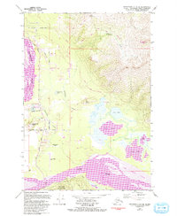
1979 Map of Anchorage C-6 SE
USGS Topo · Published 1993About this map
Butte and Bodenburg Butte emerge as key population centers in this late-century survey of the Matanuska-Susitna region, where agricultural roots meet expanding recreational and residential development. The landscape is defined by the massive braided channels of the Matanuska River and Knik River, creating the expansive Jim Creek Flats. This era shows a transition from rural homesteads to more established community infrastructure, evidenced by the Matanuska Valley School, Butte Municipal Airport, and the Butte Substation. Local social and civic life is anchored by institutions like the Bodenburg Butte Baptist Church and Pioneer Peak Baptist Church. Transportation is dominated by the Old Glenn Highway and a network of secondary roads such as Maud Road and Bodenburg Loop Road. To the south, the boundary of Chugach State Park preserves the wilder character of the terrain beneath Matanuska Peak.
Find a feature on this map
43 named features on this map. Tap any name to fly to it.
Don’t see what you’re looking for? This feature index may not catch every label — zoom into the map to look around manually.
Map Details
Editions of this 1979 Anchorage C-6 SE Map
3 editions found
Other maps of this area

1951 · Anchorage
USGS Topo · 1:250,000

1951 · Anchorage C-6
USGS Topo · 1:63,360

1951 · Anchorage C-5
USGS Topo · 1:63,360

1952 · Anchorage C-5
USGS Topo · 1:63,360

1960 · Anchorage B-6
USGS Topo · 1:63,360

1960 · Anchorage C-5
USGS Topo · 1:63,360

1960 · Anchorage B-5
USGS Topo · 1:63,360

1962 · Anchorage
USGS Topo · 1:250,000

1979 · Anchorage B-6 NW
USGS Topo · 1:25,000
1979 · Anchorage C-6 SE
USGS Topo · 1:25,000