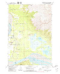
1979 Map of Anchorage C-6 SE
USGS Topo · Published 1979About this map
Matanuska River and Knik River converge in this detailed late-1970s study, framing a landscape defined by glacial silt, braided waterways, and the volcanic silhouettes of Bodenburg Butte and Burnt Butte. The community of Butte serves as the central hub, characterized by a grid of agricultural roads and residential growth. Key local landmarks include the Matanuska Valley Sch, the First Baptist Ch, and the Valley Memory Garden (Cemetery), providing clear evidence of the area's mid-century development.
Find a feature on this map
33 named features on this map. Tap any name to fly to it.
Don’t see what you’re looking for? This feature index may not catch every label — zoom into the map to look around manually.
Map Details
Editions of this 1979 Anchorage C-6 SE Map
3 editions found
Other maps of this area

1951 · Anchorage
USGS Topo · 1:250,000

1951 · Anchorage C-6
USGS Topo · 1:63,360

1951 · Anchorage C-5
USGS Topo · 1:63,360

1952 · Anchorage C-5
USGS Topo · 1:63,360

1960 · Anchorage B-6
USGS Topo · 1:63,360

1960 · Anchorage C-5
USGS Topo · 1:63,360

1960 · Anchorage B-5
USGS Topo · 1:63,360

1962 · Anchorage
USGS Topo · 1:250,000

1979 · Anchorage B-6 NW
USGS Topo · 1:25,000
1979 · Anchorage C-6 NW
USGS Topo · 1:25,000