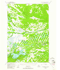
1950 Map of Anchorage C-8
USGS Topo · Published 1961About this map
Houston and Pittman emerge as key points of human activity along the Alaska Railroad corridor in the mid-20th century. The landscape is defined by an intricate network of water bodies, notably the sprawling Big Lake and the Susitna River, which anchors the northern section of the survey. The presence of the Houston Strip Mine and a nearby Gravel Pit indicates early industrial extraction, while the Big Lake Airstrip and Big Lake No 2 Airstrip highlight the importance of aviation in this road-limited region.
Find a feature on this map
36 named features on this map. Tap any name to fly to it.
Don’t see what you’re looking for? This feature index may not catch every label — zoom into the map to look around manually.
Map Details
Editions of this 1950 Anchorage C-8 Map
3 editions found
Other maps of this area

1949 · Tyonek
USGS Topo · 1:250,000

1949 · Anchorage D-7
USGS Topo · 1:63,360

1949 · Anchorage D-8
USGS Topo · 1:63,360

1950 · Anchorage C-8
USGS Topo · 1:63,360

1950 · Anchorage C-7
USGS Topo · 1:63,360

1951 · Anchorage
USGS Topo · 1:250,000

1951 · Tyonek
USGS Topo · 1:250,000

1951 · Anchorage C-7
USGS Topo · 1:63,360

1951 · Anchorage D-8
USGS Topo · 1:63,360

1951 · Anchorage D-7
USGS Topo · 1:63,360