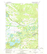
1950 Map of Anchorage C-8
USGS Topo · Published 1972About this map
The Alaska Railroad cuts a prominent line across this terrain, connecting the small settlements of Houston and Pittman during a period of post-war expansion. This survey reveals an economy and landscape defined by the intersection of resource extraction and the water-rich geography of the Matanuska-Susitna region. The Houston Strip Mine stands as a clear indicator of local industry, while the dense concentration of water bodies like Big Lake, Nancy Lake, and the Little Susitna River illustrates the complexity of the local drainage system.
Find a feature on this map
47 named features on this map. Tap any name to fly to it.
Don’t see what you’re looking for? This feature index may not catch every label — zoom into the map to look around manually.
Map Details
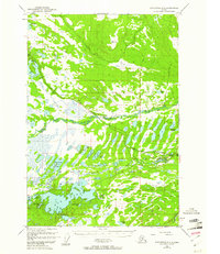
Editions of this 1950 Anchorage C-8 Map
3 editions found
Other maps of this area

1949 · Tyonek
USGS Topo · 1:250,000

1949 · Anchorage D-7
USGS Topo · 1:63,360

1949 · Anchorage D-8
USGS Topo · 1:63,360

1950 · Anchorage C-8
USGS Topo · 1:63,360

1950 · Anchorage C-7
USGS Topo · 1:63,360

1951 · Anchorage
USGS Topo · 1:250,000

1951 · Tyonek
USGS Topo · 1:250,000

1951 · Anchorage C-7
USGS Topo · 1:63,360

1951 · Anchorage D-8
USGS Topo · 1:63,360

1951 · Anchorage D-7
USGS Topo · 1:63,360