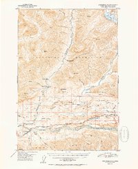
1952 Map of Anchorage D-4
USGS Topo · Published 1952About this map
The Matanuska River valley and the high slopes of the Talkeetna Mountains define this mid-century interior landscape. Centered on the settlement of Chickaloon, the map documents a transition in wilderness transport as the Glenn Highway follows the riverbank, while older routes like the Chickaloon Knik Nelchina Trail push into the backcountry. Resource extraction history is visible at the Coal Mine (Aban'd) near Coal Creek, which includes a noted Cable Tramway used for moving materials across the steep terrain.
Find a feature on this map
46 named features on this map. Tap any name to fly to it.
Don’t see what you’re looking for? This feature index may not catch every label — zoom into the map to look around manually.
Map Details
Editions of this 1952 Anchorage D-4 Map
2 editions found
Other maps of this area

1948 · Anchorage D-3
USGS Topo · 1:63,360

1948 · Anchorage D-4
USGS Topo · 1:63,360

1949 · Anchorage D-5
USGS Topo · 1:63,360

1949 · Talkeetna Mountains A-4
USGS Topo · 1:63,360

1950 · Talkeetna Mountains
USGS Topo · 1:250,000

1951 · Anchorage
USGS Topo · 1:250,000

1951 · Anchorage C-5
USGS Topo · 1:63,360

1951 · Talkeetna Mountains A-3
USGS Topo · 1:63,360

1952 · Anchorage D-5
USGS Topo · 1:63,360

1952 · Anchorage D-4
USGS Topo · 1:63,360