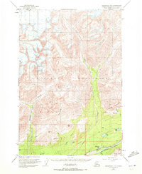
1949 Map of Anchorage D-5
USGS Topo · Published 1972About this map
The Talkeetna Mountains dominate this high-altitude landscape where the Matanuska River flows along the southern edge. Mapped in 1949 with minor revisions in the early 1970s, the area shows a wilderness defined by its drainage basins and steep summits. The corridor along the Glenn Highway provides the primary access route, passing through Castle Park and near the bench mark at Thirty-mile Lake BM 873.
Find a feature on this map
40 named features on this map. Tap any name to fly to it.
Don’t see what you’re looking for? This feature index may not catch every label — zoom into the map to look around manually.
Map Details
Editions of this 1949 Anchorage D-5 Map
3 editions found
Other maps of this area

1948 · Anchorage D-4
USGS Topo · 1:63,360

1949 · Anchorage D-5
USGS Topo · 1:63,360

1949 · Talkeetna Mountains A-4
USGS Topo · 1:63,360

1950 · Talkeetna Mountains
USGS Topo · 1:250,000

1950 · Anchorage D-6
USGS Topo · 1:63,360

1951 · Anchorage
USGS Topo · 1:250,000

1951 · Anchorage C-6
USGS Topo · 1:63,360

1951 · Anchorage C-5
USGS Topo · 1:63,360

1951 · Talkeetna Mountains A-3
USGS Topo · 1:63,360

1952 · Anchorage D-6
USGS Topo · 1:63,360