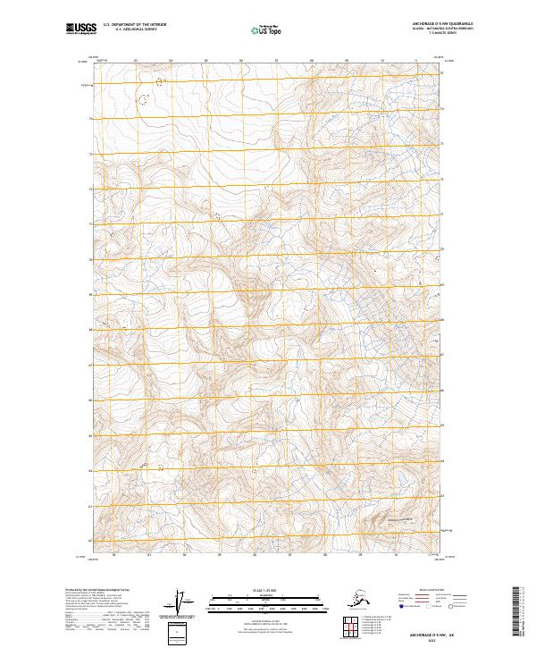
2023 Map of Anchorage D-5 NW
USGS Topo · Published 2023About this map
The high alpine terrain of the Talkeetna Mountains dominates this portion of the Matanuska-Susitna Borough, revealing a landscape defined by significant elevation changes and glacial drainages. This modern survey tracks the upper reaches of the Kings River as it cuts through the northeastern sections, while Granite Creek flows southward through the central high country. The map illustrates a wilderness area largely devoid of roads or permanent settlements, emphasizing the natural hydrography and complex topography that characterize the Matanuska-Susitna region. Surveying data from the Bureau of Land Management and the National Hydrography Dataset provide the framework for understanding the township and range boundaries that intersect these peaks, including sections of t22n r3e and t21n r4e.
Find a feature on this map
7 named features on this map. Tap any name to fly to it.
Don’t see what you’re looking for? This feature index may not catch every label — zoom into the map to look around manually.
Map Details
Editions of this 2023 Anchorage D-5 NW Map
This is the sole edition of this map. No revisions or reprints were ever made.
Other maps of this area

1949 · Anchorage D-5
USGS Topo · 1:63,360

1949 · Talkeetna Mountains A-4
USGS Topo · 1:63,360

1950 · Talkeetna Mountains
USGS Topo · 1:250,000

1950 · Anchorage D-6
USGS Topo · 1:63,360

1951 · Anchorage
USGS Topo · 1:250,000

1952 · Anchorage D-6
USGS Topo · 1:63,360

1952 · Anchorage D-5
USGS Topo · 1:63,360
1954 · Talkeetna Mountains A-4
USGS Topo · 1:63,360

1954 · Talkeetna Mountains
USGS Topo · 1:250,000
1957 · Talkeetna Mountains
USGS Topo · 1:250,000