1951 Map of Anchorage
USGS Topo · Published 1956About this map
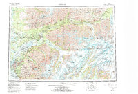
Anchorage serves as the focal point of this mid-century reconnaissance, capturing the city and its surrounding wilderness before the massive expansion of the late 20th century. The map illustrates the strategic intersection of the Alaska Railroad and the nascent Glenn Highway, highlighting the military importance of Fort Richardson and Elmendorf Airfield. To the north, the Matanuska Valley shows established agricultural and mining hubs like Palmer and Sutton, alongside the Premier Mine and Buffalo Mine. The landscape transitions from the urbanized Spenard and Mountain View districts to the massive ice fields of the Harvard Glacier and Yale Glacier in the east. This survey documents the era when Wasilla and Knik were still small outposts compared to the burgeoning central city, while the International Airport appears in its early operational form, reflecting the territory’s increasing reliance on aviation.
Find a feature on this map
91 named features on this map. Tap any name to fly to it.
Don’t see what you’re looking for? This feature index may not catch every label — zoom into the map to look around manually.
Map Details
Editions of this 1951 Anchorage Map
4 editions found

Historical Maps of Anchorage Through Time
3 maps found