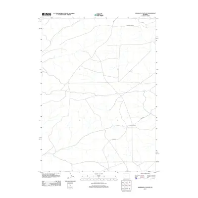
2012 Map of Anderson Canyon
USGS Topo · Published 2012About this map
The historical route of the California-Oregon Trl cuts across the northern reaches of this Wyoming landscape, marking a legacy of westward migration through Sweetwater County. This 2012 survey by the U.S. Geological Survey shows a sparsely developed terrain characterized by a complex network of intermittent drainages and high-desert topography. The most prominent landform is Little Monument, a distinctive terrain feature that likely served as a landmark for travelers and residents alike. Modern access is facilitated by a grid of rural routes including Co Line Rd, Steed Rd, and Colorado Rd, which overlay the ancient paths of the frontier. The map captures the intersection of pioneering history and contemporary land management in a region where the vastness of the geography remains the primary feature.
Find a feature on this map
5 named features on this map. Tap any name to fly to it.
Don’t see what you’re looking for? This feature index may not catch every label — zoom into the map to look around manually.
Map Details
Editions of this 2012 Anderson Canyon Map
This is the sole edition of this map. No revisions or reprints were ever made.
Other maps of this area

1955 · Preston
USGS Topo · 1:250,000

1955 · Lander
USGS Topo · 1:250,000

1958 · Lander
USGS Topo · 1:250,000

1958 · Preston
USGS Topo · 1:250,000

1961 · Lander
USGS Topo · 1:250,000

1962 · Preston
USGS Topo · 1:250,000

1968 · Anderson Canyon
USGS Topo · 1:24,000

1968 · Fontenelle Reservoir SE
USGS Topo · 1:24,000

1968 · Names Hill
USGS Topo · 1:24,000

1968 · Fontenelle Reservoir SW
USGS Topo · 1:24,000