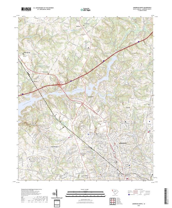
2024 Map of Anderson North
USGS Topo · Published 2024About this map
The city of Anderson serves as the focal point of this map, showcasing the urban expansion and institutional growth of this South Carolina hub. The map highlights significant educational and civic centers, including the Anderson University campus and the Anderson County Courthouse. Surrounding the city, a network of residential and rural communities such as Centerville, Northlake, and Concord are linked by a dense grid of local roads and major thoroughfares like Clemson Blvd.
Find a feature on this map
309 named features on this map. Tap any name to fly to it.
Don’t see what you’re looking for? This feature index may not catch every label — zoom into the map to look around manually.
Map Details
Editions of this 2024 Anderson North Map
This is the sole edition of this map. No revisions or reprints were ever made.
Other maps of this area

1888 · Pickens
USGS Topo · 1:125,000

1893 · Elberton
USGS Topo · 1:125,000

1894 · Pickens
USGS Topo · 1:125,000

1950 · La France
USGS Topo · 1:24,000

1951 · La France
USGS Topo · 1:24,000

1951 · Clemson
USGS Topo · 1:24,000

1954 · Greenville
USGS Topo · 1:250,000

1957 · Anderson
USGS Topo · 1:62,500

1958 · Greenville
USGS Topo · 1:250,000

1959 · Hartwell NE
USGS Topo · 1:24,000