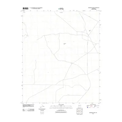
2010 Map of Anderson Peak
USGS Topo · Published 2010About this map
Datil Cemetery sits near the northwestern corner of this 2010 topographic record, serving as a primary point of interest for genealogists and local historians studying Catron County. The landscape is defined by its high desert elevations and specific geological landmarks, including the prominent Anderson Peak in the central portion and Twin Peaks to the north. Transportation patterns are clearly delineated by the path of Old Hwy 60, which cuts across the northeastern corner of the map. This route, alongside County Rd-152, reveals the modern infrastructure connecting these isolated peaks and valleys. The map illustrates a high-altitude terrain where natural features like Snake Hill have influenced the placement of these local roads and rural boundaries.
Find a feature on this map
6 named features on this map. Tap any name to fly to it.
Don’t see what you’re looking for? This feature index may not catch every label — zoom into the map to look around manually.
Map Details
Editions of this 2010 Anderson Peak Map
This is the sole edition of this map. No revisions or reprints were ever made.
Other maps of this area

1954 · Tularosa
USGS Topo · 1:250,000

1954 · Socorro
USGS Topo · 1:250,000

1958 · Socorro
USGS Topo · 1:250,000

1958 · Tularosa
USGS Topo · 1:250,000

1962 · Socorro
USGS Topo · 1:250,000

1963 · Anderson Peak
USGS Topo · 1:24,000

1963 · Datil
USGS Topo · 1:24,000

1964 · Crosby Springs
USGS Topo · 1:24,000
1965 · Sugarloaf Mountain
USGS Topo · 1:24,000
1965 · Kellog Well
USGS Topo · 1:24,000