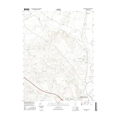
2016 Map of Andersonville
USGS Topo · Published 2016About this map
The Hopewell Culture National Historical Park anchors the southern portion of this Ross County landscape, where the Scioto River valley meets the complex drainage systems of Deer Creek and Biers Run. This modern survey illustrates the transition from the river bottomlands to the interior ridges, marked by a network of rural roads like Egypt Pike and Pennyroyal Rd. Small residential clusters and agricultural settlements such as Andersonville, Yellowbud, and Pleasant Valley are connected by a series of local cemeteries, including Springbank Cem and Browns Chapel Cem, which reflect the area's long-established family history. Significant landmarks like the Ross County Airport and recreational water bodies such as Rustic Acres Lake show the contemporary use of this territory alongside its deep archaeological significance.
Find a feature on this map
75 named features on this map. Tap any name to fly to it.
Don’t see what you’re looking for? This feature index may not catch every label — zoom into the map to look around manually.
Map Details
Editions of this 2016 Andersonville Map
This is the sole edition of this map. No revisions or reprints were ever made.
Other maps of this area

1906 · Chillicothe
USGS Topo · 1:62,500

1908 · Chillicothe
USGS Topo · 1:62,500

1911 · Era
USGS Topo · 1:62,500

1912 · Roxabell
USGS Topo · 1:62,500

1913 · Era
USGS Topo · 1:62,500

1914 · Roxabell
USGS Topo · 1:62,500

1914 · Circleville
USGS Topo · 1:62,500

1943 · Era
USGS Topo · 1:62,500

1943 · Circleville
USGS Topo · 1:62,500

1944 · Roxabell
USGS Topo · 1:62,500