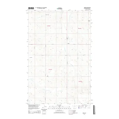
2014 Map of Andes
USGS Topo · Published 2014About this map
Andes serves as the central focal point in this portion of Richland County, characterized by a complex drainage system that defines the local topography. The landscape is carved by numerous watercourses and coulees, including Hardscrabble Cr and Garden Coulee to the north, while Timber Cr and Hay Coulee stretch across the central and southern sections. These natural features dictated the early settlement and transport patterns, as seen in the alignment of the county road network. The Andes Cem stands as a primary genealogical landmark for the area. The map illustrates the intersection of several townships, including t26n r55e and t26n r56e, providing a clear view of how land was partitioned for ranching and agricultural use in this corner of Montana.
Find a feature on this map
22 named features on this map. Tap any name to fly to it.
Don’t see what you’re looking for? This feature index may not catch every label — zoom into the map to look around manually.
Map Details
Editions of this 2014 Andes Map
This is the sole edition of this map. No revisions or reprints were ever made.
Other maps of this area

1909 · Glendive
USGS Topo · 1:250,000

1954 · Glendive
USGS Topo · 1:250,000

1954 · Wolf Point
USGS Topo · 1:250,000

1957 · Glendive
USGS Topo · 1:250,000

1958 · Wolf Point
USGS Topo · 1:250,000

1958 · Glendive
USGS Topo · 1:250,000
1969 · Twomile Creek
USGS Topo · 1:24,000

1969 · Three Buttes
USGS Topo · 1:24,000

1969 · Dugout Creek
USGS Topo · 1:24,000

1972 · Girard
USGS Topo · 1:24,000