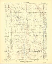
1907 Map of Andover
USGS Topo · Published 1918About this map
The Lake Shore and Michigan Southern R R dominates the transportation network of this borderland, featuring a notable Low Grade Cutoff that bypasses the primary line through Dorset. This 1905 survey reveals a landscape of dispersed agricultural hamlets and post offices along the Ohio and Pennsylvania boundary, including Leon, Padanaram, and Williamsfield P.O. The area is defined by its numerous small waterways like Pymatuning Creek, Whetstone Cr, and the upper reaches of the Shenango River, which drain the low-lying terrain.
Find a feature on this map
57 named features on this map. Tap any name to fly to it.
Don’t see what you’re looking for? This feature index may not catch every label — zoom into the map to look around manually.
Map Details
Editions of this 1907 Andover Map
4 editions found
Other maps of this area

1900 · Girard
USGS Topo · 1:62,500

1905 · Andover
USGS Topo · 1:48,000

1905 · Ashtabula
USGS Topo · 1:62,500

1905 · Bristolville
USGS Topo · 1:62,500

1905 · Jefferson
USGS Topo · 1:62,500

1906 · Conneaut
USGS Topo · 1:62,500

1906 · Linesville
USGS Topo · 1:62,500

1907 · Andover
USGS Topo · 1:62,500

1907 · Kinsman
USGS Topo · 1:62,500

1907 · Bristolville
USGS Topo · 1:62,500