
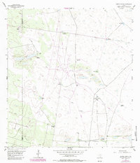
1956 Map of Andrea Ranch
USGS Topo · Published 1957About this map
Artesian wells and windmills define the remote livestock economy of the South Texas brush country along the border of Hidalgo and Kenedy counties. This 1950s survey of the Andrea Ranch area reveals a landscape where survival depended on the strategic placement of water sources like the Buenos Aires Artesian Well and the Martillo Artesian Well. The abundance of named wells—such as Tres Chivos Artesian Well and Medio Millon Well—illustrates the intensive ranching infrastructure required in this arid environment. The map also documents the Stillman Loading Pens, a critical point for gathering cattle before shipment, and the distinctive marshy lowlands of Los Cayos de lo Malo. This era of ranching is captured before modern industrial changes, showing a network of private roads and windmills like the Copita Windmill that sustained these sprawling family-held lands.
Find a feature on this map
20 named features on this map. Tap any name to fly to it.
Don’t see what you’re looking for? This feature index may not catch every label — zoom into the map to look around manually.
Map Details
Editions of this 1956 Andrea Ranch Map
2 editions found
Other maps of this area

1922 · La Sal Vieja
USGS Topo · 1:62,500

1923 · Armstrong
USGS Topo · 1:62,500

1939 · Linn
USGS Topo · 1:62,500

1949 · Mc Allen
USGS Topo · 1:250,000

1953 · Brownsville
USGS Topo · 1:250,000

1954 · McAllen
USGS Topo · 1:250,000

1956 · Julian
USGS Topo · 1:24,000

1956 · Rudolph
USGS Topo · 1:24,000

1956 · La Sal Vieja
USGS Topo · 1:24,000
1956 · Norias
USGS Topo · 1:24,000