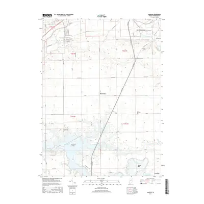
2016 Map of Andrews
USGS Topo · Published 2016About this map
The Wabash River corridor defines the northern landscape of this Huntington County region, where the town of Andrews sits at a grid of historic streets like E California St and N Main St. South of the river, the geography shifts toward the expansive Salamonie Lake, a reservoir that has altered the local drainage patterns of Little Majenica Cr and Majenica Creek. Within the waters of the lake, Monument Island remains a distinct topographical point, while the nearby Monument City Memorial Cem serves as a reminder of the community displaced by the reservoir's creation.
Find a feature on this map
77 named features on this map. Tap any name to fly to it.
Don’t see what you’re looking for? This feature index may not catch every label — zoom into the map to look around manually.
Map Details
Editions of this 2016 Andrews Map
This is the sole edition of this map. No revisions or reprints were ever made.
Other maps of this area

1950 · Lagro
USGS Topo · 1:24,000

1950 · Andrews
USGS Topo · 1:24,000

1950 · Warren
USGS Topo · 1:24,000

1950 · Mount Etna
USGS Topo · 1:24,000

1951 · Mount Etna
USGS Topo · 1:24,000

1951 · Andrews
USGS Topo · 1:24,000

1951 · Lagro
USGS Topo · 1:24,000

1952 · Warren
USGS Topo · 1:24,000

1952 · Majenica
USGS Topo · 1:24,000

1953 · La Fontaine
USGS Topo · 1:24,000