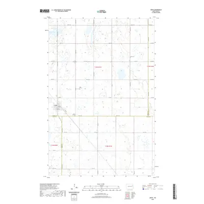
2020 Map of Aneta
USGS Topo · Published 2020About this map
Aneta anchors this rural landscape, situated at the junction of Nelson, Griggs, and Steele counties. The map documents a classic North Dakota section-line road network, where thoroughfares like Co Hwy 7 and Co Rd 20 connect dispersed farmsteads and agricultural plots. The township structure is well-defined by the borders of t149n r57w and t148n r57w, reflecting the organized settlement patterns of the Red River Valley region.
Find a feature on this map
41 named features on this map. Tap any name to fly to it.
Don’t see what you’re looking for? This feature index may not catch every label — zoom into the map to look around manually.
Map Details
Editions of this 2020 Aneta Map
This is the sole edition of this map. No revisions or reprints were ever made.
Other maps of this area

1939 · Niagara
USGS Topo · 1:62,500

1942 · McVille
USGS Topo · 1:62,500

1952 · Grand Forks
USGS Topo · 1:250,000

1952 · New Rockford
USGS Topo · 1:250,000

1956 · New Rockford
USGS Topo · 1:250,000

1956 · Grand Forks
USGS Topo · 1:250,000

1963 · Niagara SW
USGS Topo · 1:24,000
1963 · McVille SE
USGS Topo · 1:24,000

1963 · Logan Center
USGS Topo · 1:24,000

1966 · Grand Forks
USGS Topo · 1:250,000