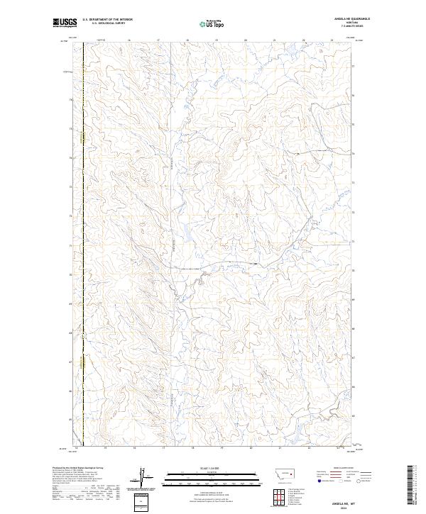
2024 Map of Angela NE
USGS Topo · Published 2024About this map
Grimes Creek flows through the center of this landscape on the border of Rosebud and Custer counties. This area is defined by its drainage patterns and the simple north-south corridor of Crow Rock Rd. The map illustrates a section of the Montana high plains where natural water features like Horse Creek dictate the layout of the land. The presence of the Rosebud and Custer county line suggests a remote agricultural or ranching district where topographical relief is more prominent than human development. By studying the contour intervals, researchers can trace the intricate coulees and ridges that separate the various townships, including t11n r45e, providing a clear look at the region's physical geography in the modern era.
Find a feature on this map
10 named features on this map. Tap any name to fly to it.
Don’t see what you’re looking for? This feature index may not catch every label — zoom into the map to look around manually.
Map Details
Editions of this 2024 Angela NE Map
This is the sole edition of this map. No revisions or reprints were ever made.
Other maps of this area

1953 · Miles City
USGS Topo · 1:250,000

1954 · Forsyth
USGS Topo · 1:250,000

1957 · Miles City
USGS Topo · 1:250,000

1957 · Forsyth
USGS Topo · 1:250,000

1958 · Miles City
USGS Topo · 1:250,000

1958 · Forsyth
USGS Topo · 1:250,000

1965 · Rock Springs School
USGS Topo · 1:24,000

1965 · Twin Buttes School
USGS Topo · 1:24,000
1965 · Crow Rock SE
USGS Topo · 1:24,000

1969 · Horse Creek Hill
USGS Topo · 1:24,000