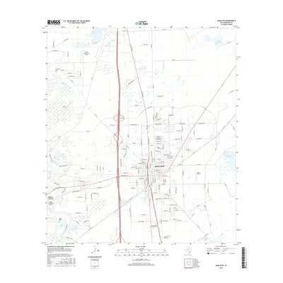
2016 Map of Angleton
USGS Topo · Published 2016About this map
Angleton serves as the central hub of this Brazoria County landscape, where the flat coastal plains are defined by an intricate network of water and aviation. The city sits at a strategic junction of rail lines and highways, while the surrounding countryside is dotted with small private airstrips like Clover Lake Farms Airport, Bailes Airport, and the Phillips Corporation Airport. These facilities reflect the area's modern infrastructure supporting local industry and ranching.
Find a feature on this map
160 named features on this map. Tap any name to fly to it.
Don’t see what you’re looking for? This feature index may not catch every label — zoom into the map to look around manually.
Map Details
Editions of this 2016 Angleton Map
This is the sole edition of this map. No revisions or reprints were ever made.
Other maps of this area

1943 · Oyster Creek
USGS Topo · 1:31,680

1943 · Rosharon
USGS Topo · 1:31,680

1943 · Danbury
USGS Topo · 1:31,680

1943 · Angleton
USGS Topo · 1:24,000

1943 · Chocolate Bayou
USGS Topo · 1:24,000

1943 · Snipe
USGS Topo · 1:31,680

1950 · Houston
USGS Topo · 1:250,000

1952 · East Columbia
USGS Topo · 1:24,000

1952 · Brazoria
USGS Topo · 1:24,000

1953 · Otey
USGS Topo · 1:24,000