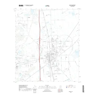
2019 Map of Angleton
USGS Topo · Published 2019About this map
Angleton serves as the focal point of this Brazoria County survey, illustrating the intersection of modern road networks and the coastal prairie landscape. The town is situated amidst a network of water features, including the winding Bastrop Bayou and Styles Bayou, while the Angleton Lateral channel highlights local water management. Near the western edge, Bailey's Prairie reflects the region's flat, open terrain, historically significant for ranching and agriculture.
Find a feature on this map
167 named features on this map. Tap any name to fly to it.
Don’t see what you’re looking for? This feature index may not catch every label — zoom into the map to look around manually.
Map Details
Editions of this 2019 Angleton Map
This is the sole edition of this map. No revisions or reprints were ever made.
Other maps of this area

1943 · Oyster Creek
USGS Topo · 1:31,680

1943 · Rosharon
USGS Topo · 1:31,680

1943 · Danbury
USGS Topo · 1:31,680

1943 · Angleton
USGS Topo · 1:24,000

1943 · Chocolate Bayou
USGS Topo · 1:24,000

1943 · Snipe
USGS Topo · 1:31,680

1950 · Houston
USGS Topo · 1:250,000

1952 · East Columbia
USGS Topo · 1:24,000

1952 · Brazoria
USGS Topo · 1:24,000

1953 · Otey
USGS Topo · 1:24,000