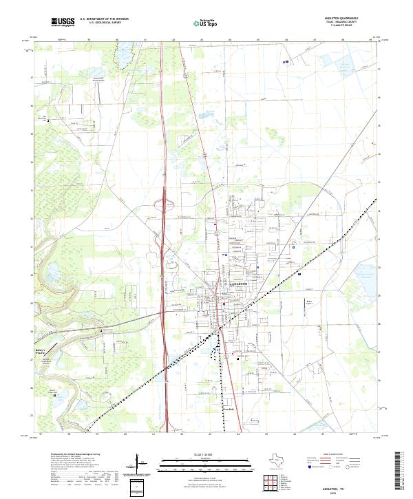
2022 Map of Angleton
USGS Topo · Published 2022About this map
The Brazoria County Courthouse stands as the central landmark of Angleton, anchoring a landscape where civic expansion meets the intricate wetlands of the Texas coastal plain. This 2022 survey illustrates the modern street grid of the county seat as it extends toward smaller nearby settlements like Van Pelt and Bailey's Prairie. The terrain is defined by a dense network of waterways and drainage features, including the Angleton Lateral, Stults Bayou, and the winding course of Oyster Creek.
Find a feature on this map
147 named features on this map. Tap any name to fly to it.
Don’t see what you’re looking for? This feature index may not catch every label — zoom into the map to look around manually.
Map Details
Editions of this 2022 Angleton Map
This is the sole edition of this map. No revisions or reprints were ever made.
Other maps of this area

1943 · Oyster Creek
USGS Topo · 1:31,680

1943 · Rosharon
USGS Topo · 1:31,680

1943 · Danbury
USGS Topo · 1:31,680

1943 · Angleton
USGS Topo · 1:24,000

1943 · Chocolate Bayou
USGS Topo · 1:24,000

1943 · Snipe
USGS Topo · 1:31,680

1950 · Houston
USGS Topo · 1:250,000

1952 · East Columbia
USGS Topo · 1:24,000

1952 · Brazoria
USGS Topo · 1:24,000

1953 · Otey
USGS Topo · 1:24,000