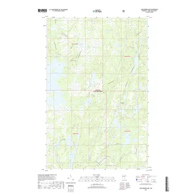
2019 Map of Angleworm Lake
USGS Topo · Published 2019About this map
The Superior National Forest encompasses this water-rich expanse of northern Minnesota, dominated by a network of interconnected lakes and pristine drainages. The landscape is defined by its glacial hydrology, where the Stuart River flows through the northwest and numerous named bodies of water like Angleworm Lake, Slim Lake, and Baldpate Lake fill the depressions of the Shield country. Land navigation is limited to a few specific corridors, most notably the historic Echo Trail and a series of portage and hiking routes including the Angleworm Trail and the Slim Lake Loop. The topography is punctuated by features such as Pictured Rocks near Hardtack Lake, illustrating the exposed bedrock characteristic of the region. This 2019 survey documents the modern recreational and conservation footprint of the Boundary Waters vicinity, emphasizing the importance of non-motorized travel through segments like the Angleworm-Trease trail.
Find a feature on this map
42 named features on this map. Tap any name to fly to it.
Don’t see what you’re looking for? This feature index may not catch every label — zoom into the map to look around manually.
Map Details
Editions of this 2019 Angleworm Lake Map
This is the sole edition of this map. No revisions or reprints were ever made.
Other maps of this area

1933 · Ely
USGS Topo · 1:62,500

1939 · Ely
USGS Topo · 1:62,500

1954 · Two Harbors
USGS Topo · 1:250,000

1954 · Hibbing
USGS Topo · 1:250,000

1954 · International Falls
USGS Topo · 1:250,000

1956 · Crab Lake
USGS Topo · 1:24,000

1957 · Two Harbors
USGS Topo · 1:250,000

1957 · Hibbing
USGS Topo · 1:250,000

1957 · International Falls
USGS Topo · 1:250,000

1957 · Quetico
USGS Topo · 1:250,000